Earthquake Geohazard Maps
Earthquake - Seismicity Maps
| GH-EQ-ENOLA-002 | Enola Swarm Area of Faulkner County, Arkansas |
| GH-EQ-NMSZ-005 | New Madrid Seismic Zone of Northeast Arkansas |
| GH-EQ-ARK-001 | Three Centuries of Earthquakes |
| GH-EQ-CO | County Seismicity Maps |
| GH-EQ-ASZM | Regional Seismicity Maps of Arkansas |
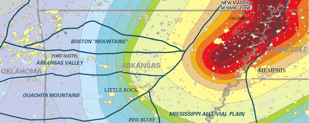
Earthquake - Modified Mercalli Intensity Maps
Earthquake - Seismic Station Maps
| GH-EQ-ARSLM-001 | Seismic Stations in Arkansas |
| GH-EQ-ARSLM-002 | Arkansas Seismic Network |
Earthquake - Special Studies
| GH-EQ-MEDIA-NWAR-002 | Recent Earthquakes in North-West Arkansas |
| GH-EQ-USGS-CERI-EVENTS-001 | Compilation of Recent Earthquakes in the Fayetteville Shale Play of North-Central Arkansas |
| W-GH-EAR-STWM-0001 | Depth to Groundwater in the Mississippi River Valley Alluvial Aquifer in Eastern Arkansas |
Earthquake - Liquefaction And Soil Amplification Maps
| GH-EQ-LSM-006 | Liquefaction Susceptibility Map of Arkansas |
| GH-EQ-LSM-007 | Liquefaction Susceptibility Map of Northeast Arkansas |
| GH-EQ-SW-SAM-011 | Soil Amplification Map of Arkansas |
| GH-EQ-SW-SAM-012 | Soil Amplification Map of Northeast Arkansas |
Earthquake - Archive Maps
| GH-EQ-MEDIA-NCAR-001 | Recent and Historic Earthquakes of North-Central Arkansas |
Earthquake - Arkansas Seismic Network Poster Series
| GH-EQ-SPP-WHAR-001 | Woolly Hollow State Park - Arkansas Seismic Network |
| GH-EQ-SPP-CCAR-005 | Cane Creek State Park - Arkansas Seismic Network |
| GH-EQ-SPP-HHAR-002 | Hobbs State Park and Conservation Area - Arkansas Seismic Network |
| GH-EQ-SPP-LCAR-003 | Lake Charles State Park - Arkansas Seismic Network |
| GH-EQ-SPP-FCAR-004 | Ozark Folk Center State Park - Arkansas Seismic Network |
| GH-EQ-SPP-WLAR-006 | White Oak Lake State Park - Arkansas Seismic Network |
Earthquake - USGS Arkansas Earthquake Posters
| Open-file Report 2011-1118 | Earthquakes in Arkansas and Vicinity 1699 - 2010 |
| Northeast Arkansas Earthquakes of 2005 | |
| Guy-Greenbrier Earthquake Swarm 2010 | |
| Guy-Greenbrier Earthquake Swarm 2010 - 2011 |
Flood Geohazard Maps
Flood - USGS - Flood Prone Maps Of The Little Rock Metropolitan Area
| Little Rock Six flood prone areas maps |
Landslide Geohazard Maps
Landslide - Usgs - Slope Stability Maps Of The Little Rock Metropolitan Area
| The Little Rock Six slope stability maps |